El Tuito | |
|---|---|
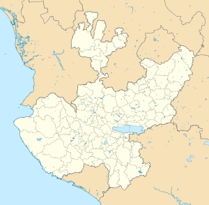
 Location of the municipality of Cabo Corrientes within the state of Jalisco | |
| Coordinates: 20°19′11″N 105°19′38″W / 20.31972°N 105.32722°W | |
| Country | |
| State | |
| Municipality | Cabo Corrientes |
| Founded | 16th Century |
| Founded as | El Tuito |
| Government | |
| • Municipal president of Cabo Corrientes | Miguel Ángel Silva Ramírez[1] (PVEM |
| Elevation | 600 m (1,969 ft) |
| Population (2019 (locality)) | |
| • Total | 3,211 |
| • Municipality | 9,034 |
| • Demonym | Tuitense |
| Time zone | UTC−6 (Central (US Central)) |
| • Summer (DST) | UTC−5 (Central) |
| Postal code | 48400 |
| Area code | +52 322 |
| Website | Cabo Corrientes Municipality official government site |
El Tuito (spelling: "el tweet-oh") is a Mexican agricultural town situated South of the Pacific Ocean's Bahía de Banderas in the Region Costa-Sierra Occidental[2] of the Mexican state of Jalisco. It is the administrative and municipal seat of the municipality of Cabo Corrientes.
El Tuito name means "small valley" or "place of beauty". The meaning of the word Tuito comes from the Nahuatl words "Teotl": god, Tiul, Tuitlán: which can mean: "place of [a] god" or "divine place" or "place of beauty".
- ^ "Alternativa Consultores. Resultados Electorales Jalisco 2021. Alternancia partidista por municipio: Cabo Corrientes: PRI → PVEM" (PDF) (in Spanish). Retrieved 10 December 2021.
- ^ "Jalisco. Gobierno del Estado de Jalisco. Cabo Corrientes" (in Spanish). Retrieved 10 December 2021.

