| Port Macquarie New South Wales—Legislative Assembly | |||||||||||||||
|---|---|---|---|---|---|---|---|---|---|---|---|---|---|---|---|
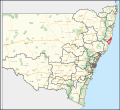
Interactive map of district boundaries from the 2023 state election | |||||||||||||||
| State | New South Wales | ||||||||||||||
| Dates current | 1988–present | ||||||||||||||
| MP | Leslie Williams | ||||||||||||||
| Party | Liberal | ||||||||||||||
| Namesake | Port Macquarie | ||||||||||||||
| Electors | 59,974 (2019) | ||||||||||||||
| Area | 1,459.69 km2 (563.6 sq mi) | ||||||||||||||
| Demographic | Provincial and rural | ||||||||||||||
| |||||||||||||||
Port Macquarie is an electoral district of the Legislative Assembly in the Australian state of New South Wales. It is represented by Leslie Williams of the Liberal Party.
It presently includes parts of coastal Port Macquarie-Hastings City Council (including Port Macquarie, Dunbogan, Bonny Hills, Kendall, Kew, Laurieton, North Haven and West Haven) and the northeast of the Mid-Coast Council (including Coopernook, Lansdowne, Moorland, Hannam Vale, Johns River and Stewarts River). Since 1991, the district also includes Lord Howe Island.[1]
While the Mid North Coast has been heavily conservative-voting throughout history, Port Macquarie is particularly conservative even by Mid North Coast standards. Labor has never won a federal or state seat that includes Port Macquarie or the surrounding suburbs. Port Macquarie was originally a National seat, but has been a Liberal seat since 2020.
- ^ "Port Macquarie". New South Wales Electoral Commission. Retrieved 23 November 2019.

