Elizovo Airport Аэропорт Елизово | |||||||||||||||||||
|---|---|---|---|---|---|---|---|---|---|---|---|---|---|---|---|---|---|---|---|
 | |||||||||||||||||||
 | |||||||||||||||||||
| Summary | |||||||||||||||||||
| Airport type | Public | ||||||||||||||||||
| Operator | Petropavlovsk-Kamchatsky Air Enterprise | ||||||||||||||||||
| Serves | Petropavlovsk-Kamchatsky | ||||||||||||||||||
| Location | Petropavlovsk-Kamchatsky, Russia | ||||||||||||||||||
| Hub for | |||||||||||||||||||
| Elevation AMSL | 131 ft / 40 m | ||||||||||||||||||
| Coordinates | 53°10′3.72″N 158°27′12.96″E / 53.1677000°N 158.4536000°E | ||||||||||||||||||
| Website | pkc.aero/en/ | ||||||||||||||||||
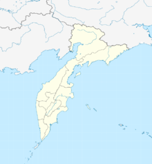
| Map | |||||||||||||||||||
Location of airport in Kamchatka Krai | |||||||||||||||||||
 | |||||||||||||||||||
| Runways | |||||||||||||||||||
| |||||||||||||||||||
| Statistics (2020) | |||||||||||||||||||
| |||||||||||||||||||
Elizovo Airport (Russian: Аэропорт Елизово) (IATA: PKC, ICAO: UHPP), also known as Yelizovo Airport or Petropavlovsk-Kamchatsky Airport, is located in the Russian Far East city of Petropavlovsk-Kamchatsky, Kamchatka Krai. Its main runway is 3,400 m (11,155 ft) long.
One of the first mentions of the Elizovo airfield dates back to 1942.
In accordance with international agreements (with Japan), Soviet Russia did not have the right to maintain military aircraft in Kamchatka. Until the end of World War II, military aviation in Kamchatka was represented by the 71st mixed aviation regiment of the 1st OKA Far Eastern Fleet and the 2nd separate naval bomber aviation regiment of the NKVD Border Troops. There was essentially no airfield network; a hydroairfield built on Lake Khalaktyrskoye was used.[clarification needed]
On May 4, 1942, the formation of the 128th Mixed Aviation Division began at the Elizovo airfield on the basis of the 71st separate mixed aviation regiment of the 1st OKA Far Eastern Fleet.
- ^ "Объемы перевозок через аэропорты России" [Transportation volumes at Russian airports]. www.favt.ru (in Russian). Federal Air Transport Agency. Archived from the original on 2021-02-20. Retrieved 10 July 2021. Archived 20 February 2021

