Elmwood | |
|---|---|
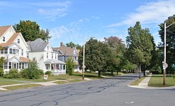
Top to bottom: Elmwood's commercial center, featuring blocks by George P. B. Alderman; neighborhood homes across from Laurel Park | |
| Coordinates: 42°11′45.33″N 72°37′28.32″W / 42.1959250°N 72.6245333°W | |
| Country | United States |
| State | Massachusetts |
| City | Holyoke |
| Wards | 3 |
| Precincts | 3A, 3B |
| Settled | c. 1725 |
| Area | |
| • Total | 0.798 sq mi (2.07 km2) |
| Elevation | 253 ft (77 m) |
| ZIP code | 01040 |
| Area code | 413 |
| GNIS feature ID | 609000[2] |
| MACRIS ID | HLY.D |
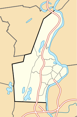
Elmwood is a neighborhood in Holyoke, Massachusetts located to the south of the city center, approximately 1 mile (1.6 km) from downtown. Elmwood is historically Holyoke's oldest village; predating the construction of the Hadley Falls Dam, it originated as part of the 3rd parish ("Ireland Parish") of West Springfield, and originally was known as Baptist Village as Holyoke's first and oldest congregation is the First Baptist Church, formally established in 1803, but maintaining a meetinghouse since 1792.[3][4]: 108 Today the neighborhood contains many historic Victorian houses and about 510 acres (210 ha) of mixed residential and commercial zoning, as well as Holyoke High School, William R. Peck Middle School, Fitzpatrick Ice Skating Rink, and Mackenzie Stadium.[1][3]
- ^ a b Spatial analysis of "Holyoke Neighborhoods" (PDF). Archived from the original (PDF) on 2 August 2017. Retrieved 3 Jun 2016.
- ^ a b "Elmwood, Holyoke, Massachusetts". Geographic Names Information System. United States Geological Survey, United States Department of the Interior. Retrieved 3 Jun 2016.
- ^ a b "MACRIS inventory record for Elmwood, Holyoke". Commonwealth of Massachusetts. Retrieved 2014-06-18.
- ^ Hungate, Jesse A. (1904). The History of the First Baptist Church of Holyoke, Mass; Together with the Proceedings of the Centennial Services. Holyoke, Mass. OCLC 7478801.
{{cite book}}: CS1 maint: location missing publisher (link)


