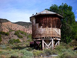
Embudo, New Mexico | |||||||||||||||||||||||||||||||
|---|---|---|---|---|---|---|---|---|---|---|---|---|---|---|---|---|---|---|---|---|---|---|---|---|---|---|---|---|---|---|---|
| Coordinates: 36°12′27″N 105°57′40″W / 36.20750°N 105.96111°W | |||||||||||||||||||||||||||||||
| Country | United States | ||||||||||||||||||||||||||||||
| State | New Mexico | ||||||||||||||||||||||||||||||
| County | Rio Arriba | ||||||||||||||||||||||||||||||
| Elevation | 5,824 ft (1,775 m) | ||||||||||||||||||||||||||||||
| Time zone | UTC-7 (Mountain (MST)) | ||||||||||||||||||||||||||||||
| • Summer (DST) | UTC-6 (MDT) | ||||||||||||||||||||||||||||||
| GNIS feature ID | 915823[1] | ||||||||||||||||||||||||||||||
| |||||||||||||||||||||||||||||||
Embudo (also Embudo Station) is an unincorporated community in Rio Arriba County, New Mexico, United States. The community runs along both sides of the Rio Grande on New Mexico State Road 68, beginning at Embudo Station located 2.9 miles (4.7 km) south of the intersection of New Mexico State Road 75, near where the Embudo Creek (Rio Embudo) flows into the Rio Grande, encompassing the communities of La Bolsa and Rinconada and ending at the Taos County Line.


