Emery County | |
|---|---|
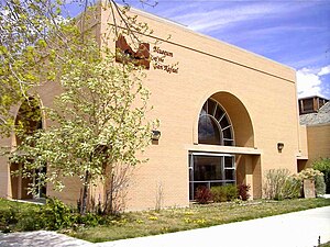
 Museum of the San Rafael Swell, in Castle Dale | |
 Location within the U.S. state of Utah | |
 Utah's location within the U.S. | |
| Coordinates: 38°59′N 110°41′W / 38.99°N 110.69°W | |
| Country | |
| State | |
| Founded | February 12, 1880 |
| Named for | George W. Emery |
| Seat | Castle Dale |
| Largest city | Huntington |
| Area | |
• Total | 4,472 sq mi (11,580 km2) |
| • Land | 4,462 sq mi (11,560 km2) |
| • Water | 9.5 sq mi (25 km2) 0.2% |
| Population (2020) | |
• Total | 9,825 |
| • Density | 2.2/sq mi (0.85/km2) |
| Time zone | UTC−7 (Mountain) |
| • Summer (DST) | UTC−6 (MDT) |
| Congressional district | 3rd |
| Website | www |
Emery County is a county in east-central Utah, United States. As of the 2020 United States Census, the population was 9,825.[1] Its county seat is Castle Dale,[2] and the largest city is Huntington.
- ^ "Emery County, Utah". United States Census Bureau. Retrieved June 30, 2023.
- ^ "Find a County". National Association of Counties. Archived from the original on May 31, 2011. Retrieved June 7, 2011.
