| Emmaville New South Wales | |
|---|---|
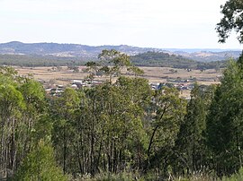
 View of Emmaville | |
| Coordinates | 29°27′S 151°36′E / 29.450°S 151.600°E |
| Population | 519 (2016 census)[1] |
| Postcode(s) | 2371 |
| Elevation | 890 m (2,920 ft) |
| Location |
|
| LGA(s) | Glen Innes Severn Council |
| County | Gough |
| State electorate(s) | Northern Tablelands |
| Federal division(s) | New England |


Emmaville is a town on the Northern Tablelands in the New England region of New South Wales, Australia. It is in the Glen Innes Severn Council district.
Emmaville is at an elevation of 890 metres AHD. At the 2006 census, the Emmaville "urban centre/locality" had a population of 247 (in the 2001 census it was 303[2]) and there were 535 persons usually resident in the Emmaville region.[1][3]
- ^ a b Australian Bureau of Statistics (25 October 2007). "Emmaville (L) (Urban Centre/Locality)". 2006 Census QuickStats. Retrieved 8 November 2007.
- ^ Australian Bureau of Statistics (9 March 2006). "Emmaville (L) (Urban Centre/Locality)". 2001 Census QuickStats. Retrieved 8 November 2007.
- ^ 2006 Census QuickStats : Emmaville (State Suburb)
