Emmet, Arkansas | |
|---|---|
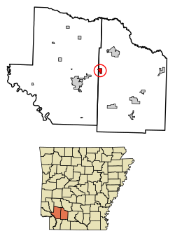
 Location of Emmet in Hempstead County and Nevada County, Arkansas. | |
| Coordinates: 33°43′22″N 93°27′57″W / 33.72278°N 93.46583°W | |
| Country | United States |
| State | Arkansas |
| Counties | Nevada, Hempstead |
| Area | |
• Total | 1.46 sq mi (3.79 km2) |
| • Land | 1.44 sq mi (3.73 km2) |
| • Water | 0.02 sq mi (0.06 km2) |
| Elevation | 305 ft (93 m) |
| Population (2020) | |
• Total | 415 |
| • Density | 287.79/sq mi (111.13/km2) |
| Time zone | UTC-6 (Central (CST)) |
| • Summer (DST) | UTC-5 (CDT) |
| ZIP code | 71835 |
| Area code | 870 |
| FIPS code | 05-21610 |
| GNIS feature ID | 2403565[2] |
Emmet is a city in Nevada and Hempstead counties in the U.S. state of Arkansas.[3] It is located at the intersection of U.S. Highway 67 and Arkansas Highway 299 in the Arkansas Timberlands region of southwest Arkansas. It is part of the larger Ark-La-Tex tri-state region. As of the 2010 census, the population of Emmet was 518.[4]
- ^ "2020 U.S. Gazetteer Files". United States Census Bureau. Retrieved October 29, 2021.
- ^ a b U.S. Geological Survey Geographic Names Information System: Emmet, Arkansas
- ^ "Emmet". Arkansas Municipal League - Local.Arkansas.Gov.
- ^ "Geographic Identifiers: 2010 Demographic Profile Data (G001): Emmet city, Arkansas". American Factfinder. U.S. Census Bureau. Retrieved April 18, 2017.[dead link]