Empire, Colorado | |
|---|---|
| Town of Empire[1] | |
 Empire as seen from Douglas Mountain | |
| Nickname: Heart of the Rocky Mountain Empire | |
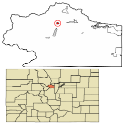
 Location of the Town of Empire in the Clear Creek County, Colorado. | |
Location of the Town of Empire in the United States | |
| Coordinates: 39°45′34″N 105°40′56″W / 39.75944°N 105.68222°W[2] | |
| Country | |
| State | |
| County | Clear Creek County[1] |
| Incorporated | April 12, 1882[3] |
| Government | |
| • Type | Statutory Town[1] |
| Area | |
| • Statutory Town[1] | 0.701 km2 (0.271 sq mi) |
| • Land | 0.695 km2 (0.268 sq mi) |
| • Water | 0.006 km2 (0.002 sq mi) |
| Elevation | 2,614 m (8,577 ft) |
| Population | |
| • Statutory Town[1] | 345 |
| • Density | 497/km2 (1,286/sq mi) |
| • Metro | 2,963,821 (19th) |
| • CSA | 3,623,560 (17th) |
| • Front Range | 5,055,344 |
| Time zone | UTC−07:00 (MST) |
| • Summer (DST) | UTC−06:00 (MDT) |
| ZIP code[5] | 80438 |
| Area code(s) | 303 and 720 |
| FIPS code | 08-24620 |
| GNIS feature ID | 2412485[2] |
| Highways | |
| Website | townofempire |
The historic Town of Empire is a Statutory Town located in Clear Creek County, Colorado, United States.[1] The town population was 345 at the 2020 United States Census, a +22.34% increase since the 2010 United States Census.[4] The town is a former mining settlement that flourished during the Colorado Silver Boom in the late 19th century. Empire is now a part of the Denver–Aurora–Lakewood, CO Metropolitan Statistical Area and the Front Range Urban Corridor.
It is located in the valley of Clear Creek west of Denver, on the north side of the valley. The town consists of several commercial establishments and residents. U.S. Highway 40 passes through the town as its ascends towards Berthoud Pass, putting the town on the direct route between Denver and Middle Park.
- ^ a b c d e "Active Colorado Municipalities". Colorado Department of Local Affairs. Retrieved October 16, 2021.
- ^ a b c U.S. Geological Survey Geographic Names Information System: Empire, Colorado
- ^ "Colorado Municipal Incorporations". State of Colorado, Department of Personnel & Administration, Colorado State Archives. December 1, 2004. Retrieved September 2, 2007.
- ^ a b c "Decennial Census P.L. 94-171 Redistricting Data". United States Census Bureau, United States Department of Commerce. August 12, 2021. Retrieved September 7, 2021.
- ^ "ZIP Code Lookup". United States Postal Service. Archived from the original (JavaScript/HTML) on August 18, 2007. Retrieved September 10, 2007.
