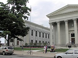
Erie County | |
|---|---|
 | |
 Location within the U.S. state of Pennsylvania | |
 Pennsylvania's location within the U.S. | |
| Coordinates: 42°06′N 80°06′W / 42.1°N 80.1°W | |
| Country | |
| State | |
| Founded | November 7, 1803 |
| Named for | Erie people |
| Seat | Erie |
| Largest city | Erie |
| Area | |
• Total | 1,558 sq mi (4,040 km2) |
| • Land | 799 sq mi (2,070 km2) |
| • Water | 759 sq mi (1,970 km2) 49% |
| Population (2020) | |
• Total | 270,876 |
| • Density | 339.1/sq mi (130.9/km2) |
| Time zone | UTC−5 (Eastern) |
| • Summer (DST) | UTC−4 (EDT) |
| Congressional district | 16th |
| Website | eriecountypa |
Erie County is a county in the Commonwealth of Pennsylvania. It is the northernmost county in Pennsylvania. As of the 2020 census, the population was 270,876.[1] Its county seat is Erie.[2] The county was created in 1800 and later organized in 1803.[3] The county is part of the Northwest Pennsylvania region of the state.[a]
- ^ "2020 Population and Housing State Data". United States Census Bureau. Retrieved August 13, 2021.
- ^ "Find a County". National Association of Counties. Archived from the original on May 31, 2011. Retrieved June 7, 2011.
- ^ "Pennsylvania: Individual County Chronologies". Pennsylvania Atlas of Historical County Boundaries. The Newberry Library. 2008. Archived from the original on March 25, 2015. Retrieved March 12, 2015.
Cite error: There are <ref group=lower-alpha> tags or {{efn}} templates on this page, but the references will not show without a {{reflist|group=lower-alpha}} template or {{notelist}} template (see the help page).

