This article relies largely or entirely on a single source. (February 2014) |
Esperia | |
|---|---|
| Comune di Esperia | |
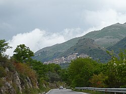
 View of Esperia | |
| Coordinates: 41°23′N 13°41′E / 41.383°N 13.683°E | |
| Country | Italy |
| Region | Lazio |
| Province | Frosinone (FR) |
| Frazioni | Badia di Esperia, Monticelli, Roccaguglielma (Esperia Superiore), San Pietro in Curolis (Esperia Inferiore) |
| Government | |
| • Mayor | Giuseppe Villani |
| Area | |
| • Total | 108.7 km2 (42.0 sq mi) |
| Elevation | 370 m (1,210 ft) |
| Population (28 February 2017)[2] | |
| • Total | 3,801 |
| • Density | 35/km2 (91/sq mi) |
| Demonym | Esperiani |
| Time zone | UTC+1 (CET) |
| • Summer (DST) | UTC+2 (CEST) |
| Postal code | 03045 |
| Dialing code | 0776 |
| Patron saint | San Clino Abate |
| Website | http://en.comuni-italiani.it/060/031/ |
Esperia is a comune (municipality) in the Province of Frosinone in the Italian region Lazio, located about 110 kilometres (68 mi) southeast of Rome and about 40 kilometres (25 mi) southeast of Frosinone. It is located within the Monti Aurunci Natural Park.
- ^ "Superficie di Comuni Province e Regioni italiane al 9 ottobre 2011". Italian National Institute of Statistics. Retrieved 16 March 2019.
- ^ "Esperia - Italy: Information, Town Profile, zip code". En.comuni-italiani.it. Retrieved 2014-02-27.


