Etimesgut | |
|---|---|
District and municipality | |
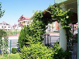
 Eryaman neighborhood in Etimesgut | |
 Map showing Etimesgut District in Ankara Province | |
| Coordinates: 39°56′45″N 32°40′10″E / 39.94583°N 32.66944°E | |
| Country | Turkey |
| Province | Ankara |
| Government | |
| • Mayor | Erdal Beşikçioğlu (CHP) |
Area | 273 km2 (105 sq mi) |
| Elevation | 843 m (2,766 ft) |
| Population (2022)[1] | 614,891 |
| • Density | 2,300/km2 (5,800/sq mi) |
| Time zone | UTC+3 (TRT) |
| Postal code | 06790 |
| Area code | 0312 |
| Website | www |
Etimesgut, formerly Ahimesut, is a municipality and metropolitan district of Ankara Province, Turkey.[2] Its area is 273 km2,[3] and its population is 614,891 (2022).[1] It mainly consists of large public housing projects, 25 km (16 mi) from Ankara city centre. Its elevation is 843 m (2,766 ft).[4]
- ^ a b Cite error: The named reference
tuikwas invoked but never defined (see the help page). - ^ Büyükşehir İlçe Belediyesi, Turkey Civil Administration Departments Inventory. Retrieved 8 June 2023.
- ^ "İl ve İlçe Yüz ölçümleri". General Directorate of Mapping. Retrieved 22 May 2023.
- ^ Falling Rain Genomics, Inc. "Geographical information on Etimesgut, Turkey". Retrieved 27 June 2023.

