Euharlee, Georgia | |
|---|---|
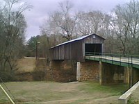
 Euharlee Creek Covered Bridge | |
 Location in Bartow County and the state of Georgia | |
| Coordinates: 34°8′50″N 84°56′11″W / 34.14722°N 84.93639°W | |
| Country | United States |
| State | Georgia |
| County | Bartow |
| Incorporated | January 1, 1976[1] |
| Named for | "she laughs as she runs" in Cherokee language.[1] |
| Government | |
| • Mayor | Craig B. Guyton[2] |
| • City Manager | James Stephens |
| Area | |
| • Total | 5.56 sq mi (14.40 km2) |
| • Land | 5.40 sq mi (14.00 km2) |
| • Water | 0.16 sq mi (0.40 km2) |
| Elevation | 682 ft (208 m) |
| Population (2020) | |
| • Total | 4,268 |
| • Density | 789.79/sq mi (304.94/km2) |
| Time zone | UTC-5 (Eastern (EST)) |
| • Summer (DST) | UTC-4 (EDT) |
| ZIP codes | 30120, 30145 |
| Area code(s) | 770/678/470/943 |
| FIPS code | 13-27988[4] |
| GNIS feature ID | 0313985[5] |
| Website | www |
Euharlee is a city in Bartow County, Georgia, United States. The population was 4,136 at the 2010 census,[6] an increase of 29% over the 2000 count of 3,208.
Euharlee is a bedroom community of Cartersville, the Bartow County seat which is located 9 miles (14 km) to the east. They are connected through Euharlee Road, and by a chain of subdivisions and homes. Euharlee is located next to Plant Bowen, which has the second-largest generating capacity of any coal-fired power plant in the United States.
- ^ a b "Euharlee". Georgia.gov. Retrieved August 30, 2014.
- ^ "City of Euharlee". Retrieved April 3, 2023.
- ^ "2020 U.S. Gazetteer Files". United States Census Bureau. Retrieved December 18, 2021.
- ^ "U.S. Census website". United States Census Bureau. Retrieved January 31, 2008.
- ^ "US Board on Geographic Names". United States Geological Survey. October 25, 2007. Retrieved January 31, 2008.
- ^ "Geographic Identifiers: 2010 Demographic Profile Data (G001): Euharlee city, Georgia". U.S. Census Bureau, American Factfinder. Archived from the original on February 12, 2020. Retrieved November 1, 2013.

