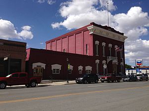
Eureka County | |
|---|---|
 | |
 Location within the U.S. state of Nevada | |
 Nevada's location within the U.S. | |
| Coordinates: 39°59′N 116°16′W / 39.98°N 116.27°W | |
| Country | |
| State | |
| Founded | 1873 |
| Named for | Eureka |
| Seat | Eureka |
| Largest community | Crescent Valley |
| Area | |
| • Total | 4,180 sq mi (10,800 km2) |
| • Land | 4,176 sq mi (10,820 km2) |
| • Water | 4.3 sq mi (11 km2) 0.1% |
| Population (2020) | |
| • Total | 1,855 |
| • Density | 0.44/sq mi (0.17/km2) |
| Time zone | UTC−8 (Pacific) |
| • Summer (DST) | UTC−7 (PDT) |
| Congressional district | 2nd |
| Website | co |
Eureka County is a county in the U.S. state of Nevada. As of the 2020 census, the population was 1,855,[1] making it the second-least populous county in Nevada. Its county seat is Eureka.[2]
Eureka County is part of the Elko Micropolitan Statistical Area.
- ^ "State & County QuickFacts". United States Census Bureau. Archived from the original on June 6, 2011. Retrieved September 23, 2013.
- ^ "County Explorer". National Association of Counties. Retrieved June 7, 2011.