| Part of a series on |
| Weather |
|---|
|
|
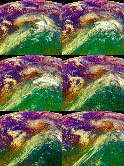
European windstorms are powerful extratropical cyclones which form as cyclonic windstorms associated with areas of low atmospheric pressure. They can occur throughout the year, but are most frequent between October and March, with peak intensity in the winter months.[1] Deep areas of low pressure are common over the North Atlantic, and occasionally start as nor'easters off the New England coast. They frequently track across the North Atlantic Ocean towards the north of Scotland and into the Norwegian Sea, which generally minimizes the impact to inland areas; however, if the track is further south, it may cause adverse weather conditions across Central Europe, Northern Europe and especially Western Europe. The countries most commonly affected include the United Kingdom, Ireland, the Netherlands, Norway, Germany, the Faroe Islands and Iceland.[2]
The strong wind phenomena intrinsic to European windstorms, that give rise to "damage footprints" at the surface, can be placed into three categories, namely the "warm jet", the "cold jet" and the "sting jet". These phenomena vary in terms of physical mechanisms, atmospheric structure, spatial extent, duration, severity level, predictability and location relative to cyclone and fronts.[3]
On average, these storms cause economic damage of around €1.9 billion per year and insurance losses of €1.4 billion per year (1990–1998). They cause the highest amount of natural catastrophe insurance loss in Europe.[4]
- ^ Sabbatelli, Tanja Dallafior Michèle Lai Tom. "European Windstorm: The Name Game | The RMS Blog". Retrieved 16 February 2020.
- ^ Martínez-Alvarado, Oscar; Suzanne L Gray; Jennifer L Catto; Peter A Clark (10 May 2012). "Sting jets in intense winter North-Atlantic windstorms". Environmental Research Letters. 7 (2): 024014. Bibcode:2012ERL.....7b4014M. doi:10.1088/1748-9326/7/2/024014.
- ^ Hewson, Tim D.; Neu, URS (1 January 2015). "Cyclones, windstorms and the IMILAST project". Tellus A. 67 (1): 27128. Bibcode:2015TellA..6727128H. doi:10.3402/tellusa.v67.27128.
- ^ "Direct losses from weather disasters". European Environment Agency. Retrieved 16 February 2020.