Evanger Municipality
Evanger herad | |
|---|---|
| Ævanger herred (historic name) | |
 View of Evanger village | |
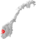
 Hordaland within Norway | |
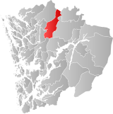
 Evanger within Hordaland | |
| Coordinates: 60°39′N 06°07′E / 60.650°N 6.117°E | |
| Country | Norway |
| County | Hordaland |
| District | Voss |
| Established | 1 Jan 1885 |
| • Preceded by | Voss Municipality |
| Disestablished | 1 Jan 1964 |
| • Succeeded by | Voss and Vaksdal municipalities |
| Administrative centre | Evanger |
| Government | |
| • Mayor (1948-1963) | Ivar Bjørgo (Sp) |
| Area (upon dissolution) | |
• Total | 590 km2 (230 sq mi) |
| Population (1963) | |
• Total | 1,326 |
| • Density | 2.2/km2 (5.8/sq mi) |
| Demonym | Vassvøring[1] |
| Time zone | UTC+01:00 (CET) |
| • Summer (DST) | UTC+02:00 (CEST) |
| ISO 3166 code | NO-1237[2] |
Evanger is a former municipality in the Voss district of the old Hordaland county in Norway. The municipality existed from 1885 until 1964 when it was dissolved and its lands split between two municipalities. The 590-square-kilometre (230 sq mi) municipality included the eastern part of the Eksingedalen valley, the area surrounding the lake Evangervatnet, and the Bergsdalen valley.[3]

The administrative centre of the municipality was the village of Evanger where Evanger Church is located. Evanger Church served the central part of the municipality. Nesheim Church and Eksingedal Church served the northern part of Evanger and Bergsdalen Church served the southern part of the municipality.
- ^ "Navn på steder og personer: Innbyggjarnamn" (in Norwegian). Språkrådet.
- ^ Bolstad, Erik; Thorsnæs, Geir, eds. (26 January 2023). "Kommunenummer". Store norske leksikon (in Norwegian). Kunnskapsforlaget.
- ^ Store norske leksikon. "Evanger – tidl. kommune" (in Norwegian). Retrieved 10 May 2014.