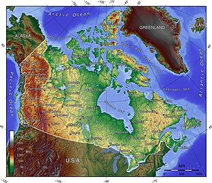
The northernmost point of land within the boundaries of Canada is Cape Columbia, Ellesmere Island, Nunavut 83°06′40″N 69°58′19″W / 83.111°N 69.972°W.[1][2] The northernmost point of the Canadian mainland is Zenith Point on Boothia Peninsula, Nunavut 72°00′07″N 94°39′18″W / 72.002°N 94.655°W.[1] The southernmost point is Middle Island, in Lake Erie, Ontario (41°41′N 82°40′W); the southernmost water point lies just south of the island, on the Ontario–Ohio border (41°40′35″N). The southernmost point of the Canadian mainland is Point Pelee, Ontario 41°54′32″N 82°30′32″W / 41.909°N 82.509°W.[1] The lowest point is sea level at 0 m,[3] whilst the highest point is Mount Logan, Yukon, at 5,959 m / 19,550 ft 60°34′01″N 140°24′18″W / 60.567°N 140.405°W.[1]
The westernmost point is Boundary Peak 187 (60°18′22.929″N 141°00′7.128″W) at the southern end of the Yukon–Alaska border, which roughly follows 141°W but leans very slightly east as it goes North 60°18′04″N 141°00′36″W / 60.301°N 141.010°W.[4][1] The easternmost point is Cape Spear, Newfoundland (47°31′N 52°37′W) 47°31′23″N 52°37′08″W / 47.523°N 52.619°W.[1] The easternmost point of the Canadian mainland is Elijah Point, Cape St. Charles, Labrador (52°13′N 55°37′W) 52°13′01″N 55°37′16″W / 52.217°N 55.621°W.[1]
Bellow includes a list of extreme and significant points of the geography of Canada.[1][2]
- ^ a b c d e f g h "Toporama". Atlas of Canada. Natural Resources Canada. 12 September 2016.
- ^ a b "Where is Canada in the World?". World Population by Country 2024 (Live). Retrieved October 26, 2024.
- ^ "Canada". The World Factbook (2024 ed.). Central Intelligence Agency. 21 June 2022. (Archived 2022 edition.)
- ^ "141st Meridian Boundary Points". International Boundary Commission. Archived from the original on 17 July 2011. Retrieved 20 December 2010.