Fairfield County | |
|---|---|
 | |
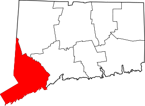
 Location within the U.S. state of Connecticut | |
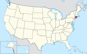
 Connecticut's location within the U.S. | |
| Coordinates: 41°14′N 73°22′W / 41.23°N 73.37°W | |
| Country | |
| State | |
| Founded | 1666 |
| Named for | The hundreds of acres of salt marsh that bordered the coast. |
| Seat | none; since 1960 Connecticut counties no longer have a county government Fairfield (1666–1853) Bridgeport (1853–1960) |
| Largest municipality | Bridgeport (population) Newtown (area) |
| Area | |
• Total | 837 sq mi (2,170 km2) |
| • Land | 625 sq mi (1,620 km2) |
| • Water | 212 sq mi (550 km2) |
| Population (2020) | |
• Total | 957,419 |
• Estimate (2021) | 958,768 |
| • Density | 1,532/sq mi (592/km2) |
| Congressional districts | 3rd, 4th, 5th |
Fairfield County is a county in the southwestern corner of the U.S. state of Connecticut. It is the most populous county in the state and was also its fastest-growing from 2010 to 2020. As of the 2020 census, the county's population was 957,419,[1] representing 26.6% of Connecticut's overall population. The closest to the center of the New York metropolitan area, the county contains four of the state's top 7 largest cities—Bridgeport (1st), Stamford (2nd), Norwalk (6th), and Danbury (7th)—whose combined population of 433,368 is nearly half the county's total population.
The United States Office of Management and Budget has designated Fairfield County as the Bridgeport–Stamford–Norwalk metropolitan statistical area.[2] The United States Census Bureau ranked the metropolitan area as the 59th most populous metropolitan statistical area of the United States in 2019. The U.S. Office of Management and Budget has further designated the metropolitan statistical area as a component of the more extensive New York–Newark–Bridgeport, NY–NJ–CT–PA combined statistical area,[2] the most populous combined statistical area and primary statistical area of the United States.[3]
As is the case with all eight of Connecticut's counties, there is no county government and no county seat. As an area, it is only a geographical point of reference. In Connecticut, the cities and towns are responsible for all local governmental activities including fire and rescue, schools, and snow removal; in a few cases, neighboring towns will share certain resources. The last county seat was Bridgeport, which had served this role from 1853 until 1960.[4] On June 6, 2022, the U.S. Census Bureau formally recognized Connecticut's nine councils of governments as county equivalents instead of the state's eight counties. Connecticut's eight historical counties continue to exist in name only, and are no longer considered for statistical purposes.[5]
Fairfield County's Gold Coast helped rank it sixth in the U.S. in per-capita personal income by the Bureau of Economic Analysis in 2005,[6] contributing substantially to Connecticut being one of the most affluent states in the U.S.[7] Other communities are more densely populated and economically diverse than the affluent areas for which the county is better known.
- ^ "State & County QuickFacts". United States Census Bureau. Retrieved December 15, 2022.
- ^ a b "OMB Bulletin No. 13-01: Revised Delineations of Metropolitan Statistical Areas, Micropolitan Statistical Areas, and Combined Statistical Areas, and Guidance on Uses of the Delineations of These Areas" (PDF). Office of Management and Budget. February 28, 2013. Archived (PDF) from the original on October 9, 2022. Retrieved March 20, 2013 – via National Archives.
- ^ "Annual Estimates of the Resident Population: April 1, 2010 to July 1, 2015 – Combined Statistical Area; and for Puerto Rico – 2015 Population Estimates". U.S. Census Bureau. Archived from the original on February 13, 2020. Retrieved October 29, 2016.
- ^ "Fairfield County Courthouse at Bridgeport - Golden Hill".
- ^ https://www.federalregister.gov/documents/2022/06/06/2022-12063/change-to-county-equivalents-in-the-state-of-connecticut Federal Register: Change to County-Equivalents in the State of Connecticut
- ^ See "BEA : CA1-3 – Per capita personal income". Archived from the original on September 29, 2007. Retrieved September 23, 2008.
- ^ The Connecticut Economy Fall 2008 Archived July 20, 2011, at the Wayback Machine
