Fairmead | |
|---|---|
 California State Route 99 passing through Fairmead | |
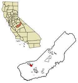
 Location in Madera County, California | |
| Coordinates: 37°04′35″N 120°11′35″W / 37.07639°N 120.19306°W | |
| Country | |
| State | |
| County | Madera |
| Area | |
| • Total | 8.360 sq mi (21.652 km2) |
| • Land | 8.360 sq mi (21.652 km2) |
| • Water | 0 sq mi (0 km2) 0% |
| Elevation | 253 ft (77 m) |
| Population (2020)[3] | |
| • Total | 1,235 |
| • Density | 150/sq mi (57/km2) |
| Time zone | UTC-8 (Pacific (PST)) |
| • Summer (DST) | UTC-7 (PDT) |
| ZIP Code | 93610 (Chowchilla) |
| GNIS feature IDs | 223335;[2] 2583011[4] |
| FIPS code | 06-23210 |
Fairmead is a census-designated place[4] in Madera County, California, United States.[2] It is located 11 miles (18 km) northwest of Madera,[5] at an elevation of 253 feet (77 m),[2] and bordered to the northwest by Chowchilla. The population was 1,235 at the 2020 census.[3]
A post office operated at Fairmead from 1913 to 1940.[5] The community is impacted by the California High-Speed Rail, as the planned route will dislocate residents.[6][7]
- ^ "2021 U.S. Gazetteer Files: California". United States Census Bureau. Retrieved June 27, 2022.
- ^ a b c d U.S. Geological Survey Geographic Names Information System: Fairmead, California
- ^ a b "P1. Race – Fairmead CDP, California: 2020 DEC Redistricting Data (PL 94-171)". U.S. Census Bureau. Retrieved June 27, 2022.
- ^ a b U.S. Geological Survey Geographic Names Information System: Fairmead Census Designated Place
- ^ a b Durham, David L. (1998). California's Geographic Names: A Gazetteer of Historic and Modern Names of the State. Clovis, Calif.: Word Dancer Press. p. 771. ISBN 1-884995-14-4.
- ^ Sheehan, Tim (September 11, 2020). "High-speed rail junction near Chowchilla, connecting to Gilroy, approved. What's next?". The Fresno Bee. Retrieved May 30, 2021.
- ^ Sheehan, Tim (May 30, 2021). "A disadvantaged Valley town will see millions in investment, with high-speed rail agreement". The Fresno Bee. Retrieved May 30, 2021.
