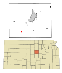
Falun, Kansas | |
|---|---|
 Location within Saline County and Kansas | |
 | |
| Coordinates: 38°40′16″N 97°45′34″W / 38.67111°N 97.75944°W[1] | |
| Country | United States |
| State | Kansas |
| County | Saline |
| Founded | 1870 |
| Elevation | 1,348 ft (411 m) |
| Population | |
| • Total | 83 |
| Time zone | UTC-6 (CST) |
| • Summer (DST) | UTC-5 (CDT) |
| ZIP code | 67442 |
| Area code | 785 |
| FIPS code | 20-22900[1] |
| GNIS ID | 476938[1] |
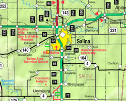
Falun is a census-designated place (CDP) in southwestern Saline County, Kansas, United States.[1] As of the 2020 census, the population was 83.[2] It lies southwest of Salina and northwest of Lindsborg at the intersection of Forsse Road and Hedberg Road, about 7.5 miles west of Interstate 135 highway, or about 8 miles west of Assaria.[3] It lies next to an abandoned railroad.
Falun is a part of the Salina micropolitan area.
- ^ a b c d e "Falun, Kansas", Geographic Names Information System, United States Geological Survey, United States Department of the Interior
- ^ a b "Profile of Falun, Kansas (CDP) in 2020". United States Census Bureau. Archived from the original on November 13, 2021. Retrieved November 13, 2021.
- ^ Rand McNally. The Road Atlas '08. Chicago: Rand McNally, 2008, p. 41.