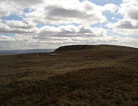
| Fan Llia | |
|---|---|
 The summit of Fan Llia | |
| Highest point | |
| Elevation | 632 m (2,073 ft) |
| Prominence | 100 m (330 ft) |
| Parent peak | Fan Fawr |
| Listing | SubHuMP, Hewitt, Nuttall |
| Coordinates | 51°51′22″N 3°32′35″W / 51.8561°N 3.5430°W |
| Naming | |
| English translation | (the) peak near (the stream called) Llia[1] |
| Language of name | Welsh |
| Geography | |
| Location | Powys, Wales |
| Parent range | Brecon Beacons |
| OS grid | SN937186 |
| Topo map | OS Landranger 160 |
Fan Llia is a subsidiary summit of Fan Fawr in the Fforest Fawr section of the Brecon Beacons National Park, Wales. In common with other peaks in the Fforest Fawr uplands it lies within the county of Powys.[2]
The hill has the form of a broad ridge aligned south-south-west to north-north-east peaking at an altitude of 632 m. It has a subsidiary top to the north which is known as Fan Dringarth and which attains a height of 617 m. Its broad northern ridge is eventually truncated by the cliffs of Craig Cwm-du.
A number of features of archaeological interest are to be found on its flanks including several house platforms.
- ^ Hywel Wyn Owen and Richard Morgan, Dictionary of the Place Names of Wales (Llandysul, 2007), t. 146.
- ^ Nuttall, John & Anne (1999). The Mountains of England & Wales - Volume 1: Wales (2nd edition ed.). Milnthorpe, Cumbria: Cicerone. ISBN 1-85284-304-7.