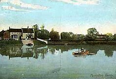
| Farndon | |
|---|---|
| Village and civil parish | |
 St. Peter's Church | |
 Parish map | |
Location within Nottinghamshire | |
| Area | 2.75 sq mi (7.1 km2) |
| Population | 2,479 (2021) |
| • Density | 901/sq mi (348/km2) |
| OS grid reference | SK 769518 |
| • London | 110 mi (180 km) SSE |
| District | |
| Shire county | |
| Region | |
| Country | England |
| Sovereign state | United Kingdom |
| Post town | NEWARK |
| Postcode district | NG24 |
| Dialling code | 01636 |
| Police | Nottinghamshire |
| Fire | Nottinghamshire |
| Ambulance | East Midlands |
| UK Parliament | |
| Website | www |


Farndon is a small village and civil parish in Newark and Sherwood district of Nottinghamshire, England. It lies along the historic Fosse road on the banks of the River Trent and is 3 miles (4 km) south-west of Newark-on-Trent. The population of the civil parish as of the 2011 census was 2,405, this increased to 2,479 at the 2021 census.[1] The A46 road previously ran through the village until the development of a new dual carriageway bypass.[2]
- ^ UK Census (2021). "2021 Census Area Profile – Farndon (Newark and Sherwood) parish (E04012614)". Nomis. Office for National Statistics. Retrieved 1 February 2024.
- ^ "Civil Parish population 2011". Neighbourhood Statistics. Office for National Statistics. Retrieved 8 April 2016.
