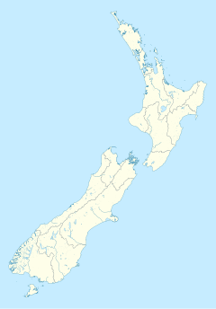
Feilding railway station | |||||||||||
|---|---|---|---|---|---|---|---|---|---|---|---|
 Feilding railway station | |||||||||||
| General information | |||||||||||
| Location | New Zealand | ||||||||||
| Coordinates | 40°13′35″S 175°34′08″E / 40.226472°S 175.568784°E | ||||||||||
| Elevation | 72 m (236 ft) | ||||||||||
| Line(s) | North Island Main Trunk | ||||||||||
| Distance | Wellington 152.95 km (95.04 mi) | ||||||||||
| History | |||||||||||
| Opened | 1 October 1876[1] | ||||||||||
| Closed | 25 June 2012 | ||||||||||
| Rebuilt | 7 December 1961 after fire | ||||||||||
| Electrified | June 1988 | ||||||||||
| Services | |||||||||||
| |||||||||||
| |||||||||||
Feilding railway station was a station on the North Island Main Trunk line in Feilding, New Zealand. It was opened on 1 October 1876 and closed on 25 June 2012.[2] The station is now used by Feilding Information Centre[3] and an occasional excursion train.[4]
The south wall of the station is decorated with a mural,[5] which features Feilding's 1999[6] clock tower, which has a 1902 clock.[7] The nearby former goods shed has a mural depicting the X Class loco[8] stored at Feilding.[9] The murals were by Eric Brew,[10] who was a resident artist and painted many other murals in the town.[11]
Feilding had hoped to be the junction of the North Island Main Trunk and the Marton–New Plymouth line so had made Kimbolton Road exceptionally wide, but that honour went to Marton and Longburn.[12]
- ^ Names & Opening & Closing Dates of Railway Stations in New Zealand by Juliet Scoble (2012)
- ^ Scoble, Juliet (2012). Names & Opening & Closing Dates of Railway Stations in New Zealand, 1863 to 2012. Wellington. p. 32.
{{cite book}}: CS1 maint: location missing publisher (link) - ^ "Information Centre - Feilding". www.feilding.co.nz. Retrieved 21 January 2021.
- ^ "Upcoming trips & events – Feilding and District Steam Rail Society Inc". Retrieved 21 January 2021.
- ^ "58 State Hwy 54". Google Maps. July 2020. Retrieved 28 January 2021.
- ^ "Feilding Clock Tower". www.feildingheritage.nz. Retrieved 28 January 2021.
- ^ "Feilding town centre". teara.govt.nz. Retrieved 28 January 2021.
- ^ "62 State Hwy 54". Google Maps. December 2018. Retrieved 28 January 2021.
- ^ "FDSR - X442 Information". steamrail.org.nz. Retrieved 28 January 2021.
- ^ "ERIC BREW ARTIST". MANAWATU'S IRON GATES EXPERIENCE. Retrieved 28 January 2021.
- ^ "Things to see and do in Feilding, New Zealand". www.newzealand.com. Retrieved 28 January 2021.
- ^ Mulgan, Alan (1939). The City of the Strait: Wellington and its province. Wellington: Reed. p. 283.

