Fier County
Qarku i Fierit (Albanian) | |
|---|---|
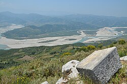
 Vjosa Valley | |
 Map of Albania with Fier County highlighted | |
| Coordinates: 40°45′N 19°35′E / 40.750°N 19.583°E | |
| Country | |
| Seat | Fier |
| Subdivisions | |
| Government | |
| • Council chairman | Evis Sema (PS) [1] |
| Area | |
• Total | 1,890 km2 (730 sq mi) |
| • Rank | 8th |
| Population (2023[2]) | |
• Total | 240,377 |
| • Rank | 2nd |
| • Density | 130/km2 (330/sq mi) |
| Time zone | UTC+1 (CET) |
| • Summer (DST) | UTC+2 (CEST) |
| HDI (2022) | 0.762 high · 10th |
| NUTS Code | AL032 |
| Website | Official Website |
Fier County (Albanian pronunciation: [fieɽ]; Albanian: Qarku Fier), officially the County of Fier (Albanian: Qarku i Fierit), is a county in the Southern Region of the Republic of Albania. It is the eighth largest by area and the third most populous of the twelve counties, with about 240,000 people within an area of 1,890 km2 (730 sq mi). The county borders on the Adriatic Sea to the west, the counties of Tirana to the north, Elbasan to the northeast, Berat to the east, Gjirokastër to the southeast and Vlorë to the south. It is divided into six municipalities, Fier, Divjakë, Lushnjë, Mallakastër, Patos and Roskovec, all of whom incorporate 42 administrative units.[3]
- ^ "Konstituohet Këshilli i Qarkut Fier! Evis Sema rizgjidhet për një mandat të dytë si kryetare".
- ^ "Main Results of the Population and Housing Census 2023" (PDF). INSTAT.
- ^ "Law nr. 115/2014" (PDF) (in Albanian). p. 6370. Retrieved 25 February 2022.
