First Mesa, Arizona | |
|---|---|
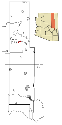
 Location in Navajo County and the state of Arizona | |
| Coordinates: 35°50′20″N 110°22′00″W / 35.83889°N 110.36667°W | |
| Country | United States |
| State | Arizona |
| County | Navajo |
| Area | |
| • Total | 15.74 sq mi (40.78 km2) |
| • Land | 15.74 sq mi (40.76 km2) |
| • Water | 0.01 sq mi (0.02 km2) |
| Elevation | 5,660 ft (1,730 m) |
| Population (2020) | |
| • Total | 1,352 |
| • Density | 85.91/sq mi (33.17/km2) |
| Time zone | UTC-7 (MST) |
| ZIP code | 86042 |
| Area code | 928 |
| FIPS code | 04-23512 |
| GNIS feature ID | 2408213[2] |
First Mesa (Hopi: Wàlpi) is a census-designated place (CDP) in Navajo County, Arizona, United States, on the Hopi Reservation. As of the 2010 census, the CDP population was 1,555, spread among three Hopi villages atop the 5,700-foot (1,740 m) mesa: Hano (or Tegua, Arizona), Sitsomovi (or Sichomovi), and Waalpi (or Walpi).
- ^ "2020 U.S. Gazetteer Files". United States Census Bureau. Retrieved October 29, 2021.
- ^ a b U.S. Geological Survey Geographic Names Information System: First Mesa, Arizona
