Flosta Municipality
Flosta herred | |
|---|---|
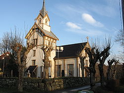
 View of the Flosta Church | |
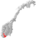
 Aust-Agder within Norway | |
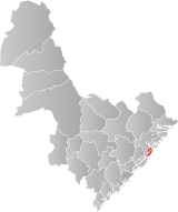
 Flosta within Aust-Agder | |
| Coordinates: 58°31′43″N 08°56′02″E / 58.52861°N 8.93389°E | |
| Country | Norway |
| County | Aust-Agder |
| District | Østre Agder |
| Established | 1 Jan 1902 |
| • Preceded by | Dypvåg Municipality |
| Disestablished | 1 Jan 1962 |
| • Succeeded by | Moland Municipality |
| Administrative centre | Kilsund |
| Area (upon dissolution)[1] | |
| • Total | 22.8 km2 (8.8 sq mi) |
| Population (1962) | |
| • Total | 1,205 |
| • Density | 53/km2 (140/sq mi) |
| Official language | |
| • Norwegian form | Bokmål[2] |
| Time zone | UTC+01:00 (CET) |
| • Summer (DST) | UTC+02:00 (CEST) |
| ISO 3166 code | NO-0916[4] |
Flosta is a former municipality in the old Aust-Agder county in Norway. The 22.8-square-kilometre (8.8 sq mi) municipality existed from 1902 until its dissolution in 1962. It is currently part of the municipality of Arendal in Agder county. The administrative center of Flosta was at Staubø in the village of Kilsund. The municipality primarily encompassed the two islands of Flostaøya and Tverrdalsøya and about 9 square kilometres (3.5 sq mi) on the mainland just north of the islands including the villages of Eikeland, Borås, and Vatnebu.[1][5]
- ^ a b Kiær, Anders Nicolai; Helland, Amund; Vibe, Johan; Strøm, Boye (1904). "Flosta herred". Norges land og folk: Nedenes amt (in Norwegian). Norway: H. Aschehoug & Company. p. 168. Retrieved 28 November 2017.
- ^ "Norsk Lovtidende. 2den Afdeling. 1932. Samling af Love, Resolutioner m.m". Norsk Lovtidend (in Norwegian). Oslo, Norway: Grøndahl og Søns Boktrykkeri: 453–471. 1932.
- ^ "Forskrift om målvedtak i kommunar og fylkeskommunar" (in Norwegian). Lovdata.no.
- ^ Bolstad, Erik; Thorsnæs, Geir, eds. (26 January 2023). "Kommunenummer". Store norske leksikon (in Norwegian). Kunnskapsforlaget.
- ^ Thorsnæs, Geir, ed. (3 August 2017). "Flosta". Store norske leksikon (in Norwegian). Kunnskapsforlaget. Retrieved 28 November 2017.