Forsyth, Montana | |
|---|---|
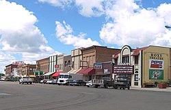
 Downtown Forsyth | |
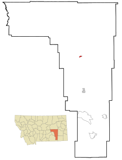
 Location of Forsyth, Montana | |
| Coordinates: 46°15′59″N 106°40′40″W / 46.26639°N 106.67778°W[1] | |
| Country | United States |
| State | Montana |
| County | Rosebud |
| Area | |
| • Total | 1.17 sq mi (3.03 km2) |
| • Land | 1.15 sq mi (2.98 km2) |
| • Water | 0.02 sq mi (0.05 km2) |
| Elevation | 2,520 ft (770 m) |
| Population (2020) | |
| • Total | 1,647 |
| • Density | 1,432.17/sq mi (552.89/km2) |
| Time zone | UTC-7 (Mountain (MST)) |
| • Summer (DST) | UTC-6 (MDT) |
| ZIP code | 59327 |
| Area code | 406 |
| FIPS code | 30-27700 |
| GNIS feature ID | 0771501[1] |
| Website | www |
Forsyth is a city in and the county seat of Rosebud County, Montana, United States.[3] The population was 1,647 at the 2020 census.[4] Forsyth was established in 1876 as the first settlement on the Yellowstone River, and in 1882 residents named the town after General James William Forsyth[5] who commanded Fort Maginnis, Montana during the Indian Wars and the 7th Cavalry at the Wounded Knee Massacre. The town has long been a transportation nexus, starting with steamboats on the river and progressing to the Northern Pacific Railway and Interstate 94.
- ^ a b c U.S. Geological Survey Geographic Names Information System: Forsyth, Montana
- ^ "ArcGIS REST Services Directory". United States Census Bureau. Retrieved September 5, 2022.
- ^ "Find a County". National Association of Counties. Archived from the original on May 31, 2011. Retrieved June 7, 2011.
- ^ "U.S. Census website". United States Census Bureau. Retrieved November 2, 2021.
- ^ "Origins of Names on Milwaukee". Roundup Record-Tribune & Winnett Times. August 22, 1940. p. 6. Retrieved April 27, 2015.