Fort Apache, Arizona | |
|---|---|
 Commanding Officer's Quarters at Fort Apache Historic Site | |
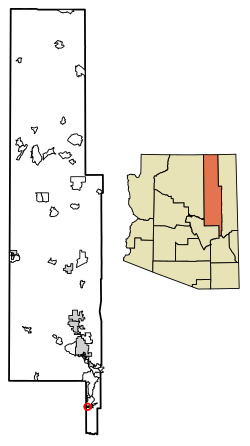
 Location of Fort Apache in Navajo County, Arizona. | |
| Coordinates: 33°47′22″N 109°59′52″W / 33.78944°N 109.99778°W | |
| Country | United States |
| State | Arizona |
| County | Navajo |
| Area | |
• Total | 1.15 sq mi (2.98 km2) |
| • Land | 1.14 sq mi (2.95 km2) |
| • Water | 0.01 sq mi (0.04 km2) |
| Elevation | 5,059 ft (1,542 m) |
| Population (2010) | |
• Total | 143 |
| Time zone | UTC-7 (Mountain (MST)) |
| ZIP code | 85926 |
| Area code | 928 |
| GNIS feature ID | 2582784[2] |
Fort Apache (Western Apache: Tłʼog Hagai) is an unincorporated community in Navajo County, Arizona, United States. Today's settlement of Fort Apache incorporates elements of the original U.S. Cavalry post Fort Apache, and lies within the Fort Apache Indian Reservation, home of the White Mountain Apache Tribe, 2 miles (3 km) east of Canyon Day. Fort Apache has a post office with ZIP code 85926.[4]
- ^ "2016 U.S. Gazetteer Files". United States Census Bureau. Retrieved July 18, 2017.
- ^ a b U.S. Geological Survey Geographic Names Information System: Fort Apache, Arizona
- ^ "Population and Housing Unit Estimates". Retrieved June 9, 2017.
- ^ ZIP Code Lookup

