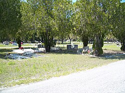
Fort Denaud, Florida | |
|---|---|
 Fort Denaud Cemetery | |
| Coordinates: 26°44′32″N 81°30′36″W / 26.74222°N 81.51000°W | |
| Country | |
| State | |
| County | Hendry |
| Area | |
| • Total | 20.76 sq mi (53.78 km2) |
| • Land | 20.05 sq mi (51.94 km2) |
| • Water | 0.71 sq mi (1.84 km2) |
| Elevation | 14 ft (4 m) |
| Population (2020) | |
| • Total | 2,049 |
| • Density | 102.18/sq mi (39.45/km2) |
| Time zone | UTC−5 (Eastern (EST)) |
| • Summer (DST) | UTC−4 (EDT) |
| ZIP code | 33935 |
| Area code | 863 |
| FIPS code | 12-23730[2] |
| GNIS feature ID | 2583343[3] |
Fort Denaud is a census-designated place (CDP) and former fort in Hendry County, Florida, United States. As of the 2020 census, the population of the CDP was 2,049, up from 1,694 at the 2010 census. It is part of the Clewiston, Florida Micropolitan Statistical Area (μSA).
- ^ "2020 U.S. Gazetteer Files". United States Census Bureau. Retrieved October 31, 2021.
- ^ "Geographic Identifiers: 2010 Demographic Profile Data (G001): Fort Denaud CDP, Florida". American Factfinder. U.S. Census Bureau. Retrieved April 26, 2017.[dead link]
- ^ "Fort Denaud Census Designated Place". Geographic Names Information System. United States Geological Survey, United States Department of the Interior.

