| Fort Huachuca | |
|---|---|
| Cochise County, Arizona Near Sierra Vista, Arizona in United States | |
 | |
      Insignia of units stationed at Fort Huachuca Motto: "From sabres to satellites" | |
 Interactive map outlining Fort Huachuca | |
| Coordinates | 31°33′19″N 110°20′59″W / 31.555357°N 110.349754°W |
| Type | Army Post |
| Site information | |
| Owner | United States |
| Controlled by | |
| Open to the public | Yes |
| Condition | Active |
| Website | Official Website |
| Site history | |
| Built | 3 March 1877 |
| In use | 143 years |
| Battles/wars | Apache Wars 1849–1924 Pancho Villa Expedition 1916–1917 |
| Garrison information | |
| Current commander | |
| Past commanders | List of Past Commanders
|
| Garrison | USAG Fort Huachuca |
| Occupants |
|
| Designations | National Register of Historic Places |
Fort Huachuca | |
 Historic Commanding Officer's quarters | |
| Nearest city | Sierra Vista, Arizona |
| Area | 76,000 acres (310 km2) |
| Built | 1877 |
| Architect | US Army |
| NRHP reference No. | 74000443 |
| Significant dates | |
| Added to NRHP | 20 November 1974[3] |
| Designated NHLD | 11 May 1976[4] |
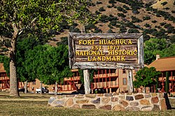
Fort Huachuca is a United States Army installation, established on 3 March 1877 as Camp Huachuca. The garrison is under the command of the United States Army Installation Management Command. It is in Cochise County in southeast Arizona, approximately 15 miles (24 km) north of the border with Mexico and at the northern end of the Huachuca Mountains, adjacent to the town of Sierra Vista. From 1913 to 1933, the fort was the base for the "Buffalo Soldiers" of the 10th Cavalry Regiment. During the build-up of World War II, the fort had quarters for more than 25,000 male soldiers and hundreds of WACs. In the 2010 census, Fort Huachuca had a population of about 6,500 active duty soldiers, 7,400 military family members, and 5,000 civilian employees. Fort Huachuca has over 18,000 people on post during weekday work hours.
The major tenant units are the United States Army Network Enterprise Technology Command (NETCOM) and the United States Army Intelligence Center. Libby Army Airfield is on post and shares its runway with Sierra Vista Municipal Airport. It was an alternate but never used landing location for the Space Shuttle. Fort Huachuca is the headquarters of Army Military Auxiliary Radio System. Other units include the Joint Interoperability Test Command, the Information Systems Engineering Command, the Electronic Proving Ground (USAEPG), and the Intelligence and Electronic Warfare Directorate.[5]
The fort has a radar-equipped aerostat (Tethered Aerostat Radar System), one of a series maintained for the Drug Enforcement Administration (DEA) by Harris Corporation. The aerostat is northeast of Garden Canyon and supports the DEA drug interdiction mission by detecting low-flying aircraft attempting to enter the United States from Mexico. Fort Huachuca contains the Western Division of the Advanced Airlift Tactics Training Center which is based at the 139th Airlift Wing, Rosecrans Air National Guard Base in Saint Joseph, Missouri.
- ^ "Invitation Letter from BG Hiestand to LTG Walters" (PDF). cia.gov/library. Central Intelligence Agency. Archived from the original (PDF) on 23 January 2017. Retrieved 25 August 2020.
- ^ "Photograph/color portrait of BG Stubblebine". azmemory.azlibrary.gov. Arizona Memory Project. Retrieved 25 August 2020.
- ^ "National Register Information System". National Register of Historic Places. National Park Service. 23 January 2007.
- ^ "Fort Huachuca". National Historic Landmark summary listing. National Park Service. Archived from the original on 2 February 2015. Retrieved 27 September 2007.
- ^ "Fort Huachuca Units/Tenants". home.army.mil/huachuca/. United States Army. Retrieved 25 August 2020.

