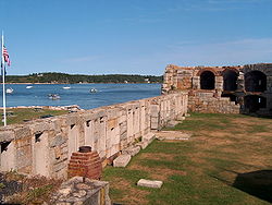
Fort Popham Memorial | |
 Fort Popham and the Kennebec River | |
| Location | Phippsburg, Maine |
|---|---|
| Coordinates | 43°45′17″N 69°47′02″W / 43.75472°N 69.78389°W[1] |
| Built | 1861 |
| Architect | US Army Corps of Engineers |
| NRHP reference No. | 69000012 |
| Fort Popham | |
| Part of Coast Defenses of the Kennebec | |
| Phippsburg, Maine | |
| Type | Fortification |
| Site information | |
| Owner | Public - State of Maine |
| Controlled by | State of Maine |
| Open to the public | partly |
| Site history | |
| Built | 1857–1869 |
| Built by | U.S. Army Corps of Engineers |
| In use | 1864–1865, 1898–1899, 1917–1918, 1941–1945 |
| Materials | Granite |
| Garrison information | |
| Garrison |
|
| Added to NRHP | 1 October 1969 |
Fort Popham is a Civil War-era coastal defense fortification at the mouth of the Kennebec River in Phippsburg, Maine. It is located in sight of the short-lived Popham Colony and, like the colony, named for George Popham, the colony's leader. The site is preserved as Fort Popham State Historic Site.[2]
- ^ "Fort Popham (historical)". Geographic Names Information System. United States Geological Survey, United States Department of the Interior.
- ^ Cite error: The named reference
dacfwas invoked but never defined (see the help page).
