| Fort Prince George | |
|---|---|
| Allegheny County, Pennsylvania (present day Pittsburgh, Pennsylvania) | |
| Coordinates | 40°26′23″N 79°58′35″W / 40.43972°N 79.97639°W |
| Type | Military fort |
| Site history | |
| Built | 1754 |
| Garrison information | |
| Past commanders | Captain William Trent Lieutenant John Fraser Ensign Edward Ward |
| Designated | May 8, 1959 |

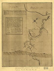
Fort Prince George (sometimes referred to as Trent's Fort) was an incomplete fort on what is now the site of Pittsburgh, at the confluence of the Allegheny and Monongahela Rivers in Allegheny County, Pennsylvania. The plan to occupy the strategic forks was formed by Virginia Lieutenant Governor Robert Dinwiddie, on the advice of Major George Washington, whom Dinwiddie had sent on a mission to warn French commanders they were on English territory in late 1753, and who had made a military assessment and a map of the site. The fort was still under construction when it was discovered by the French, who sent troops to capture it. The French then constructed Fort Duquesne on the site.

