| Fort Riley | |
|---|---|
| Riley / Geary counties, near Junction City, Kansas | |
 Shoulder sleeve insignia of First Infantry Division | |
| Coordinates | 39°06′N 96°49′W / 39.100°N 96.817°W |
| Type | Army post |
| Area | 101,733 acres (159.0 sq mi; 411.7 km2) |
| Site information | |
| Controlled by | United States Army |
| Status | Active |
| Website | Official website |
| Site history | |
| Built | January, 1853 |
| In use | 1853–present |
| Garrison information | |
| Current commander | Colonel Gerald Nunziato |
| Garrison | |
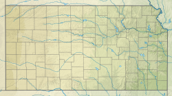
Fort Riley is a United States Army installation located in North Central Kansas, on the Kansas River, also known as the Kaw, between Junction City and Manhattan. The Fort Riley Military Reservation covers 101,733 acres (41,170 ha) in Geary and Riley counties.[1] The Fort consists of six functional areas, including the Main Post, Camp Funston, Marshall Army Airfield (MAAF), Camp Whitside, Camp Forsyth, and Custer Hill.[2] The portion of the fort that contains housing development is part of the Fort Riley census-designated place, with a residential population of 9,230 as of the 2020 census.[3] The ZIP Code is 66442.
- ^ "Fort Riley Military Value Analysis Data; June 2014" (PDF). army.mil. Archived from the original (PDF) on January 25, 2017. Retrieved March 31, 2018.
- ^ Story, Madison (2023). Fort Riley Firing Ranges and Military Training Lands: A History and Analysis (pdf). US Army Engineer Research and Development Center. p. 1. Archived (PDF) from the original on September 2, 2024. Retrieved September 2, 2024.
- ^ "Profile of Fort Riley, Kansas (CDP) in 2020". United States Census Bureau. Archived from the original on November 15, 2021. Retrieved November 15, 2021.

