Fort Scott, Kansas | |
|---|---|
City and County seat | |
 Downtown Fort Scott (2024) | |
 Location within Bourbon County and Kansas | |
 | |
| Coordinates: 37°49′42″N 94°42′14″W / 37.82833°N 94.70389°W[1] | |
| Country | United States |
| State | Kansas |
| County | Bourbon |
| Founded | 1850s |
| Platted | 1857 |
| Incorporated | 1860 |
| Named for | Gen. Winfield Scott |
| Area | |
| • Total | 5.63 sq mi (14.58 km2) |
| • Land | 5.59 sq mi (14.47 km2) |
| • Water | 0.04 sq mi (0.11 km2) |
| Elevation | 843 ft (257 m) |
| Population | |
| • Total | 7,552 |
| • Density | 1,300/sq mi (520/km2) |
| Time zone | UTC-6 (CST) |
| • Summer (DST) | UTC-5 (CDT) |
| ZIP code | 66701 |
| Area code | 620 |
| FIPS code | 20-24000 |
| GNIS ID | 485575[1] |
| Website | fscity.org |
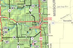
Fort Scott is a city in and the county seat of Bourbon County, Kansas, United States.[1] As of the 2020 census, the population of the city was 7,552.[3][4] It is named for Gen. Winfield Scott.[5] The city is located 88 miles (142 km) south of Kansas City on the Marmaton River. It is the home of the Fort Scott National Historic Site and the Fort Scott National Cemetery.
- ^ a b c d U.S. Geological Survey Geographic Names Information System: Fort Scott, Kansas
- ^ "2019 U.S. Gazetteer Files". United States Census Bureau. Retrieved July 24, 2020.
- ^ a b "Profile of Fort Scott, Kansas in 2020". United States Census Bureau. Archived from the original on November 8, 2022. Retrieved November 8, 2022.
- ^ "QuickFacts; Fort Scott, Kansas; Population, Census, 2020 & 2010". United States Census Bureau. Archived from the original on August 27, 2021. Retrieved August 27, 2021.
- ^ Gannett, Henry (1905). The Origin of Certain Place Names in the United States. Govt. Print. Off. p. 129.