Fort St. James | |
|---|---|
| District of Fort St. James[1] | |
 | |
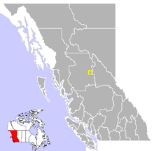
 Location of Fort St. James in British Columbia | |
| Coordinates: 54°26′35″N 124°15′15″W / 54.44306°N 124.25417°W | |
| Country | Canada |
| Province | British Columbia |
| Region | Omineca Country |
| Regional district | Regional District of Bulkley Nechako |
| Founded | 1806 |
| Incorporated | 1952 |
| Government | |
| • Governing body | Municipal Council |
| • Mayor | Martin Elphee |
| Area | |
• Total | 23.47 km2 (9.06 sq mi) |
| Elevation | 700 m (2,300 ft) |
| Population (2016) | |
• Total | 1,598 |
| • Density | 72.0/km2 (186/sq mi) |
| Time zone | UTC−8 (PST) |
| • Summer (DST) | UTC−7 (PDT) |
| Postal code span | |
| Area code(s) | +250, +778 |
| Highways | 27 |
| Waterways | Stuart Lake, Stuart River, Necoslie River, Nahounli Creek |
| Website | www |
| Official name | Fort St. James National Historic Site of Canada |
| Designated | 1948 |
Fort St. James is a district municipality and former fur trading post in northern central British Columbia, Canada. It is located on the south-eastern shore of Stuart Lake in the Omineca Country, at the northern terminus of Highway 27, which connects to Highway 16 at Vanderhoof.
It is home to the John Prince Research Forest which features abundant wildlife.[2] This community celebrated its bicentennial in 2016 and is incorporated as a district municipality.
- ^ "British Columbia Regional Districts, Municipalities, Corporate Name, Date of Incorporation and Postal Address" (XLS). British Columbia Ministry of Communities, Sport and Cultural Development. Archived from the original on 13 July 2014. Retrieved 2 November 2014.
- ^ "John Prince Research Forest".

