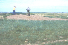
Fort Thompson, South Dakota | |
|---|---|
 | |
 Location in Buffalo County and the state of South Dakota | |
| Coordinates: 44°03′10″N 99°24′48″W / 44.05278°N 99.41333°W | |
| Country | United States |
| State | South Dakota |
| County | Buffalo |
| Incorporated | 1889[1] |
| Area | |
• Total | 12.60 sq mi (32.63 km2) |
| • Land | 10.38 sq mi (26.88 km2) |
| • Water | 2.22 sq mi (5.75 km2) |
| Elevation | 1,437 ft (438 m) |
| Population | |
• Total | 1,224 |
| • Density | 117.95/sq mi (45.54/km2) |
| Time zone | UTC−6 (Central (CST)) |
| • Summer (DST) | UTC−5 (CDT) |
| ZIP code | 57339 |
| Area code | 605 |
| FIPS code | 46-22340[5] |
| GNIS feature ID | 2393006[3] |
Fort Thompson is a census-designated place (CDP) in Buffalo County, South Dakota, United States. The population was 1,282 at the 2010 census, making it the largest settlement on the Crow Creek Reservation.
Fort Thompson was named in honor of Clark W. Thompson, superintendent of Indian Affairs.[6]

- ^ "SD Towns" (PDF). South Dakota State Historical Society. Archived from the original (PDF) on February 10, 2010. Retrieved February 12, 2010.
- ^ "ArcGIS REST Services Directory". United States Census Bureau. Retrieved October 15, 2022.
- ^ a b U.S. Geological Survey Geographic Names Information System: Fort Thompson, South Dakota
- ^ Cite error: The named reference
USCensusDecennial2020CenPopScriptOnlywas invoked but never defined (see the help page). - ^ "U.S. Census website". United States Census Bureau. Retrieved January 31, 2008.
- ^ Federal Writers' Project (1940). South Dakota place-names, v.1-3. American guide series. University of South Dakota. p. 38.