| Fort Washington State Park | |
|---|---|
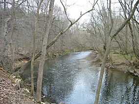
 Wissahickon Creek runs through Fort Washington State Park. | |
| Location | Montgomery County, Pennsylvania, U.S. |
| Nearest town | Fort Washington and Flourtown |
| Coordinates | 40°07′11″N 75°14′01″W / 40.11972°N 75.23361°W[1] |
| Area | 493 acres (200 ha) |
| Elevation | 328 feet (100 m) [1] |
| Established | 1953 as a state park |
| Named for | The temporary fort built by George Washington’s troops in the fall of 1777, before heading to Valley Forge |
| Administrator | Pennsylvania Department of Conservation and Natural Resources |
| Fort Washington State Park | |
| Pennsylvania State Parks | |
Fort Washington State Park is a 493-acre (200 ha) Pennsylvania state park in Springfield and Whitemarsh Townships in Montgomery County, Pennsylvania. The park is noted for the springtime flowering of dogwood trees, and is popular with families for picnics and hiking. It is approximately 17 miles (27 km) north of Philadelphia, 2 miles (3.2 km) from exit 339 of the Pennsylvania Turnpike.
- ^ a b "Fort Washington State Park". Geographic Names Information System. United States Geological Survey. August 2, 1979. Retrieved 2008-03-04.

