| Fort Wilkins Historic State Park | |
|---|---|
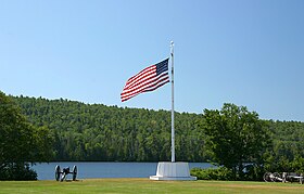
 Flagpole in front of Lake Fanny Hooe at Fort Wilkins | |
| Location | Grant Township, Keweenaw County, Michigan, United States |
| Nearest city | Copper Harbor, Michigan |
| Coordinates | 47°28′02″N 87°52′11″W / 47.46722°N 87.86972°W |
| Area | 987 acres (399 ha) |
| Elevation | 620 feet (190 m) [1] |
| Established | 1923[2] |
| Administered by | Michigan Department of Natural Resources |
| Designation | Michigan state park |
| Website | Official website |
Fort Wilkins | |
 Officer Quarters | |
| Location | Fort Wilkins State Park |
| Built | 1844 |
| NRHP reference No. | 70000279 |
| Added to NRHP | July 8, 1970 |
Fort Wilkins Historic State Park is a historic preservation and public recreation area operated by the Michigan Department of Natural Resources at Copper Harbor, Michigan.[3] The park preserves the restored 1844 army military outpost, Fort Wilkins, which was placed on the National Register of Historic Places in 1970.[4] The state park's 987 acres (399 ha) include camping and day-use facilities as well as the Copper Harbor Lighthouse, built in 1866.[3] The park is a "Cooperating Site" of the Keweenaw National Historical Park.
- ^ "Lake Fanny Hooe". Geographic Names Information System. United States Geological Survey, United States Department of the Interior.
- ^ Cite error: The named reference
mdnr3was invoked but never defined (see the help page). - ^ a b Cite error: The named reference
mdnrwas invoked but never defined (see the help page). - ^ Cite error: The named reference
npgallerywas invoked but never defined (see the help page).

