| Fossil Creek | |
|---|---|
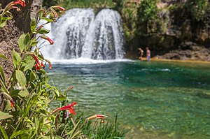
 Waterfall on Fossil Creek | |
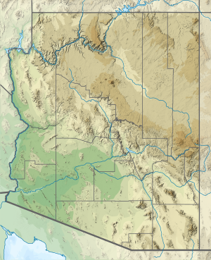
 Fossil Creek proposal map (March 2011) | |
| Etymology | the resemblance to fossils of the stream's rocks and vegetation, coated with travertine[2] |
| Native name | Hakhavsuwa (Yavapai) |
| Location | |
| Country | United States |
| State | Arizona |
| County | Coconino, Yavapai, Gila |
| City | Strawberry |
| Physical characteristics | |
| Source | |
| • coordinates | 34°26′07″N 111°30′31″W / 34.43528°N 111.50861°W[1] |
| • elevation | 6,510 ft (1,980 m)[3] |
| Mouth | Verde River |
• coordinates | 34°18′21″N 111°40′32″W / 34.30583°N 111.67556°W[1] |
• elevation | 2,543 ft (775 m)[1] |
| Length | 17 mi (27 km)[4][5] |
| Basin size | 135 sq mi (350 km2)[4] |
| Discharge | |
| • location | Fossil Creek Bridge[n 1] |
| • average | 43 cu ft/s (1.2 m3/s)[n 2] |
| • minimum | 39 cu ft/s (1.1 m3/s) |
| • maximum | 885 cu ft/s (25.1 m3/s) |
| Type | Wild, Recreational |
| Designated | March 30, 2009 |
Fossil Creek (Yavapai: Hakhavsuwa or Vialnyucha) is a perennial stream accessed by forest roads near the community of Camp Verde in the U.S. state of Arizona. Primary access is from Forest Road 708 off Arizona State Route 260 east of Camp Verde. A tributary of the Verde River, Fossil Creek flows from its headwaters on the Mogollon Rim to meet the larger stream near the former Childs Power Plant.
Fossil Springs, near the headwaters, emits upwards of 20,000 US gallons (76 m3) per minute that flow into the creek year-round. Calcium carbonate, precipitating from the 72 °F (22 °C) water from the springs, creates travertine dams and deposits for several miles downstream. The Fossil Creek system is the fourth largest producer of travertine in the United States.
Fossil Creek is one of only two streams in Arizona included in the National Wild and Scenic Rivers System. The creek and its riparian corridor provide habitat for a wide variety of flora and fauna, some listed as endangered or otherwise imperiled. Its former power-plant complex is listed as a National Historic District. Since restoration of the stream's natural flow in 2008, an increase in recreational visits has raised concerns about overuse and has led to road closings and other restrictions.
- ^ a b c "Fossil Creek". Geographic Names Information System. United States Geological Survey. February 8, 1980. Retrieved November 15, 2012.
- ^ "Childs Irving Hydroelectric Project History". APS. Archived from the original on May 10, 2012. Retrieved November 18, 2012.
- ^ Source elevation derived from Google Earth search using GNIS source coordinates.
- ^ a b Duperrault 2003, pp. 10–13.
- ^ Cite error: The named reference
topoquest multiple quadswas invoked but never defined (see the help page). - ^ a b "Water-Data Report 2011: 09507480 Fossil Creek Near Strawberry, AZ" (PDF). U.S. Geological Survey. Retrieved November 20, 2012.
- ^ a b Schlinger, Charlie (March 28, 2004). "Fossil Creek Gaging Station Alternatives Evaluation and Recommendations" (PDF). Northern Arizona University. Retrieved November 21, 2012.[permanent dead link]
Cite error: There are <ref group=n> tags on this page, but the references will not show without a {{reflist|group=n}} template (see the help page).
