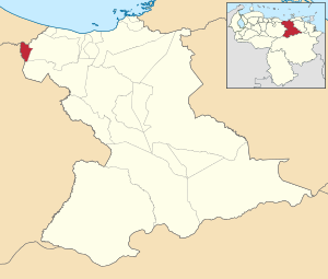
Francisco del Carmen Carvajal Municipality
Municipio Francisco del Carmen Carvajal | |
|---|---|
 Location in Anzoátegui | |
| Coordinates: 9°52′56″N 65°40′02″W / 9.8822°N 65.6672°W | |
| Country | |
| State | Anzoátegui |
| Municipal seat | Valle de Guanape[*] |
| Government | |
| • Mayor | Franklyn Guillen (PSUV) |
| Area | |
| • Total | 228.7 km2 (88.3 sq mi) |
| Population (2011) | |
| • Total | 14,653 |
| • Density | 64/km2 (170/sq mi) |
| Time zone | UTC−4 (VET) |
| Area code(s) | 0281 |
| Website | Official website |
The Francisco del Carmen Carvajal Municipality is one of the 21 municipalities (municipios) that makes up the eastern Venezuelan state of Anzoátegui and, according to the 2011 census by the National Institute of Statistics of Venezuela, the municipality has a population of 14,653.[1] The town of Valle de Guanape is the shire town of the Francisco del Carmen Carvajal Municipality.[2]
- ^ "Archived copy". Archived from the original on 15 March 2016. Retrieved 8 November 2015.
{{cite web}}: CS1 maint: archived copy as title (link) - ^ http://www.ocei.gov.ve/secciones/division/Anzoategui.zip [permanent dead link]


