| Frankford Creek Tookany Creek, Tacony Creek | |
|---|---|
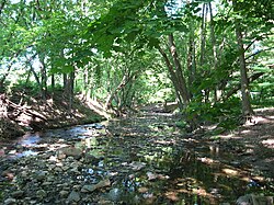
 Tookany Creek in Cheltenham Township | |
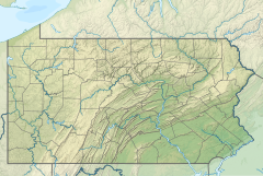
Location of the Creek in Pennsylvania | |
| Location | |
| Country | United States |
| State | Pennsylvania |
| Region | Delaware Valley |
| District | Montgomery County and Philadelphia County |
| Municipality | Cheltenham Township and City of Philadelphia |
| Physical characteristics | |
| Source | Hill Crest |
| • location | Cheltenham |
| Mouth | Delaware River |
• location | Bridesburg/Port Richmond |
• coordinates | 39°59′7.5372″N 75°4′15.2394″W / 39.985427000°N 75.070899833°W |
| Basin features | |
| River system | Delaware River |
Frankford Creek[1] is a minor tributary of the Delaware River in southeast Pennsylvania. It derived its name from today's Frankford, Philadelphia neighborhood.
The stream originates as Tookany Creek[citation needed] at Hill Crest in Cheltenham Township and meanders eastward, then southeastward, throughout Cheltenham Township, until a sharp bend near the Philadelphia border at Lawncrest, where the place names Toxony and Tookany were used in historic times; the stream is still known as Tookany Creek in this region, where it flows southwest. Turning south into Philadelphia at the crotch of Philadelphia's V-shaped border, the creek is called Tacony Creek;[2] from here southward, it is considered the informal boundary separating Northeast Philadelphia from the rest of the city.
The Philadelphia neighborhoods of Olney and Feltonville lie on the western side of the stream in this area while Northwood, Lawncrest, Summerdale, and Frankford lie on the eastern side. It continues to be called the Tacony at least until the smaller Wingohocking Creek merges with it in Juniata Park, within the city-owned golf course. Beyond Castor Avenue it is known as Frankford Creek until the stream's confluence with the Delaware River in the Bridesburg neighborhood of Philadelphia. The section of stream known as Frankford Creek is 3.1 miles (5.0 km) long, and the upstream section known as Tacony Creek, from Hill Crest, is 11.1 miles (17.9 km) long.[3]
The Lenape Native Americans who lived within its watershed called the creek Quessionwonmink, which means “Eel Skin River.” Some believe the word Tacony to be derived from another Lenni Lenape word meaning "forest" or "wilderness".
- ^ U.S. Geological Survey Geographic Names Information System: Frankford Creek
- ^ U.S. Geological Survey Geographic Names Information System: Tacony Creek
- ^ U.S. Geological Survey. National Hydrography Dataset high-resolution flowline data. The National Map Archived 2012-03-29 at the Wayback Machine, accessed April 1, 2011
