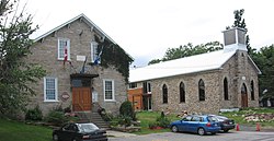
Franklin | |
|---|---|
 | |
 Location within Le Haut-Saint-Laurent RCM | |
| Coordinates: 45°02′N 73°55′W / 45.033°N 73.917°W[1] | |
| Country | Canada |
| Province | Quebec |
| Region | Montérégie |
| RCM | Le Haut-Saint-Laurent |
| Constituted | March 31, 1973 |
| Government | |
| • Mayor | Yves Métras |
| • Federal riding | Salaberry—Suroît |
| • Prov. riding | Huntingdon |
| Area | |
| • Total | 112.76 km2 (43.54 sq mi) |
| • Land | 112.33 km2 (43.37 sq mi) |
| Population (2021)[4] | |
| • Total | 1,635 |
| • Density | 14.6/km2 (38/sq mi) |
| • Pop (2016-21) | |
| • Dwellings | 800 |
| Time zone | UTC−5 (EST) |
| • Summer (DST) | UTC−4 (EDT) |
| Postal code(s) | |
| Area code(s) | 450 and 579 |
| Highways | |
| Website | www |
Franklin is a Canadian municipality located in the Montérégie region of Quebec along the Canada–US border. The population as of the 2021 Canadian census was 1,635.
- ^ Cite error: The named reference
toponymiewas invoked but never defined (see the help page). - ^ a b "Répertoire des municipalités: Geographic code 69010". www.mamh.gouv.qc.ca (in French). Ministère des Affaires municipales et de l'Habitation.
- ^ Riding history for Beauharnois—Salaberry, Quebec from the Library of Parliament
- ^ a b "Franklin, Quebec (Code 2469010) Census Profile". 2021 census. Government of Canada - Statistics Canada.
