| Frant | |
|---|---|
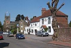
 A view of Frant | |
Location within East Sussex | |
| Area | 31.9 km2 (12.3 sq mi) [1] |
| Population | 1,645 (2011)[2] |
| • Density | 111/sq mi (43/km2) |
| OS grid reference | TQ590354 |
| • London | 33 miles (53 km) NNW |
| District | |
| Shire county | |
| Region | |
| Country | England |
| Sovereign state | United Kingdom |
| Post town | TUNBRIDGE WELLS |
| Postcode district | TN3 |
| Dialling code | 01892 |
| Police | Sussex |
| Fire | East Sussex |
| Ambulance | South East Coast |
| UK Parliament | |
| Website | http://www.frant.info/ |
Frant is a village and civil parish in the Wealden District of East Sussex, England, on the Kentish border about three miles (5 km) south of Royal Tunbridge Wells.
When the iron industry was at its height, much of the village was owned by ironmasters. Smuggling occurred here in the 17th and 18th centuries, and one of the turnpike roads (now the A267) came through here at that time.[3]
Frant church is dedicated to St Alban[4] and there is a church school.[5] St Alban's Frant was a major surveying point for the Anglo-French Survey (1784–1790) calculating the precise distance and relationship between the Paris Observatory and the Royal Greenwich Observatory, undertaken by General William Roy.
There are three public houses in the parish: the Abergavenny Arms on the A267 in Frant, the George Inn in the High Street and the Brecknock Arms at Bells Yew Green. The George Inn plays host to the Sloe Gin World Championships each December, attracting entries from around the globe.[6]
Lieutenant-Colonel John By, the Royal Engineer who headed the Rideau Canal project in Ottawa, 1826–1832, is buried here. He was also the builder of Bytown, which became Ottawa, the capital of Canada.
- ^ "East Sussex in Figures". East Sussex County Council. Archived from the original on 28 December 2012. Retrieved 26 April 2008.
- ^ "Civil Parish population 2011". Retrieved 9 October 2015.[permanent dead link]
- ^ "Frant history". Archived from the original on 15 December 2005. Retrieved 12 January 2006.
- ^ St Albans church Archived 19 February 2007 at the Wayback Machine
- ^ "Frant Church of England Primary School - Home". www.frantcep.e-sussex.sch.uk. Archived from the original on 9 June 2023. Retrieved 9 June 2023.
- ^ "Sloe Ginster World Championships: Makers compete for title". BBC News. 16 December 2015. Archived from the original on 26 October 2018. Retrieved 1 March 2019.
