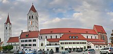
Freising | |
|---|---|
 | |
| Country | Germany |
| State | Bavaria |
| Adm. region | Upper Bavaria |
| Capital | Freising |
| Government | |
| • District admin. | Helmut Petz (FW) |
| Area | |
| • Total | 800 km2 (300 sq mi) |
| Population (31 December 2023)[1] | |
| • Total | 186,276 |
| • Density | 230/km2 (600/sq mi) |
| Time zone | UTC+01:00 (CET) |
| • Summer (DST) | UTC+02:00 (CEST) |
| Vehicle registration | FS |
| Website | lra-freising.bayern.de |


Freising is a Landkreis (district) in Bavaria, Germany. Following a recent ranking of the German magazine Focus-Money comparing all German districts it is number one concerning economic growth abilities. It is bounded by (from the north and clockwise) the districts of Kelheim, Landshut, Erding, Munich, Dachau and Pfaffenhofen. The district is located north of the Munich metropolitan area. The Isar and Amper rivers run in parallel from southwest to northeast. North of the rivers there is the Hallertau, a hilly region mainly used for growing hop.
- ^ Genesis Online-Datenbank des Bayerischen Landesamtes für Statistik Tabelle 12411-003r Fortschreibung des Bevölkerungsstandes: Gemeinden, Stichtag (Einwohnerzahlen auf Grundlage des Zensus 2011).

