Fremont, New Hampshire | |
|---|---|
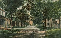
 Main Street in 1909 | |
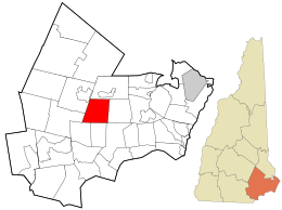
 Location in Rockingham County and the state of New Hampshire. | |
| Coordinates: 42°59′27″N 71°08′33″W / 42.99083°N 71.14250°W | |
| Country | United States |
| State | New Hampshire |
| County | Rockingham |
| Incorporated | 1764 |
| Villages | Fremont Pages Corner |
| Government | |
| • Select Board |
|
| • Town Administrator | Heidi Carlson |
| Area | |
• Total | 17.4 sq mi (45.1 km2) |
| • Land | 17.2 sq mi (44.5 km2) |
| • Water | 0.2 sq mi (0.6 km2) 1.30% |
| Elevation | 155 ft (47 m) |
| Population (2020)[2] | |
• Total | 4,739 |
| • Density | 276/sq mi (106.5/km2) |
| Time zone | UTC-5 (Eastern) |
| • Summer (DST) | UTC-4 (Eastern) |
| ZIP code | 03044 |
| Area code | 603 |
| FIPS code | 33-27940 |
| GNIS feature ID | 0873602 |
| Website | www |
Fremont is a town in Rockingham County, New Hampshire, United States. The population was 4,739 at the 2020 census,[1] up from 4,283 at the 2010 census.[3] Fremont is crossed by the Rockingham Recreation Trail (a rail trail) and NH Route 107.
- ^ a b "2021 U.S. Gazetteer Files – New Hampshire". United States Census Bureau. Retrieved December 22, 2021.
- ^ "Fremont town, Rockingham County, New Hampshire: 2020 DEC Redistricting Data (PL 94-171)". U.S. Census Bureau. Retrieved December 22, 2021.
- ^ United States Census Bureau, U.S. Census website, 2010 Census figures. Retrieved March 23, 2011.
