| French Island National Park Victoria | |
|---|---|
Former cataphote for maritime navigation, French Island National Park, November 2017 | |
 | |
| Nearest town or city | Melbourne |
| Coordinates | 38°19′51″S 145°23′18″E / 38.33083°S 145.38833°E |
| Established | 28 June 1998[1] |
| Area | 111 km2 (42.9 sq mi)[1] |
| Managing authorities | Parks Victoria |
| Website | French Island National Park |
| See also | Protected areas of Victoria |

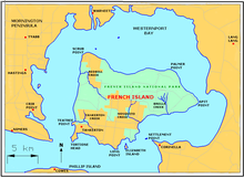
The French Island National Park is a national park located in the Greater Melbourne region of Victoria, Australia. The 11,100-hectare (27,000-acre)[1] national park is 61 kilometres (38 mi) southeast of Melbourne on French Island within Western Port and accessible only via water.
- ^ a b c "French Island National Park Management Plan" (PDF). Parks Victoria. October 1998. p. 12. ISBN 0-7311-3130-4. Archived from the original (PDF) on 4 March 2016. Retrieved 12 August 2014.
