Fruitland, Idaho | |
|---|---|
 | |
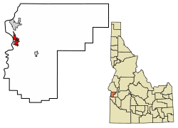
 Location of Fruitland in Payette County, Idaho. | |
| Coordinates: 44°0′58″N 116°55′17″W / 44.01611°N 116.92139°W | |
| Country | United States |
| State | Idaho |
| County | Payette |
| Area | |
• Total | 2.16 sq mi (5.59 km2) |
| • Land | 2.15 sq mi (5.58 km2) |
| • Water | 0.01 sq mi (0.01 km2) |
| Elevation | 2,228 ft (679 m) |
| Population | |
• Total | 4,684 |
• Estimate (2019)[3] | 5,426 |
| • Density | 2,519.03/sq mi (972.42/km2) |
| Time zone | UTC-7 (Mountain (MST)) |
| • Summer (DST) | UTC-6 (MDT) |
| ZIP code | 83619 |
| Area code(s) | 208, 986 |
| FIPS code | 16-28990 |
| GNIS feature ID | 0396521 |
| Website | fruitland |
Fruitland is a city along the Snake and Payette rivers in Payette County, Idaho, United States. It lies along U.S. Route 95 in the Treasure Valley of southwest Idaho, about 50 miles (80 km) west of Boise on the border with Oregon. It is part of the Ontario Micropolitan Area. Fruitland is named after apple orchards that surround the community, and its slogan is "The Big Apple of Idaho."
As of the 2010 census, the city had a total population of 4,684, up from 3,805 in 2000.[4]
- ^ "2019 U.S. Gazetteer Files". United States Census Bureau. Retrieved July 9, 2020.
- ^ Cite error: The named reference
wwwcensusgovwas invoked but never defined (see the help page). - ^ Cite error: The named reference
USCensusEst2019CenPopScriptOnlyDirtyFixDoNotUsewas invoked but never defined (see the help page). - ^ Spokesman-Review Archived 2017-04-21 at the Wayback Machine - 2010 census - Fruitland, Idaho - accessed 2011-12-23