Parts of this article (those related to recent history) need to be updated. (April 2024) |
Funafuti | |
|---|---|
|
Top: International Airport; Middle: Fetu Ao Lima (Morning Star Church); Bottom: Funafuti coastline | |
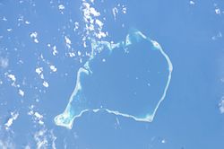
 Aerial image of Funafuti atoll | |
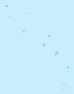
 Map of the atoll | |
| Coordinates: 08°31′S 179°12′E / 8.517°S 179.200°E | |
| Country | Tuvalu |
| Government | |
| • Parliament representatives | Tuafafa Latasi, Simon Kofe |
| Area | |
• Total | 2.4 km2 (0.9 sq mi) |
| Population (2017) | |
• Total | 6,320 |
| • Density | 2,600/km2 (6,800/sq mi) |
| ISO 3166 code | TV-FUN |
Funafuti is an atoll, comprising numerous islets, that serves as the capital of Tuvalu.[1][2] As of the 2017 census, it has a population of 6,320 people.[3] More people live in Funafuti than the rest of Tuvalu combined, with it containing approximately 60% of the nation's population. The main islet, Fongafale, hosts Vaiaku, the administrative center of the nation.
Funafuti was first sighted by Europeans in 1819 by Arent Schuyler de Peyster, an American sea captain, who named it Ellice's Island. Between 1850 and 1875, Funafati, with its navigable lagoon, was targeted by blackbirders who kidnapped natives to work at mines off the coast of Peru and Chile.[4] In 1892, each of the Ellice Islands was declared a British protectorate by Captain Herbert Gibson of HMS Curacoa. In 1909, the first resident magistrate was appointed to Funafuti; in 1915, Funafuti, along with the rest of the Ellice Islands, were incorporated into the Gilbert and Ellice Islands as a crown colony.[4] In October 1942, during World War II, Funafuti was occupied by American forces to serve as a strategic staging ground for the Gilbert and Marshall Islands campaign.[5] Over the course of the war, the Americans dredged Funafuti's lagoon harbor and established the atoll's airfield, now known as Funafuti International Airport. In October 1972, Cyclone Bebe struck Funafuti, causing extensive damage; despite this Funafuti was chosen as the administrative capital of the newly founded nation of Tuvalu in 1978. As the capital of Tuvalu, Funafuti is by far the most urbanized atoll in the country, and is the hub of governmental, administrative, and economic activities.[6]
The atoll consists of a narrow sweep of land between 20 and 400 metres (66 and 1,312 feet) wide, encircling a large lagoon (Te Namo) 18 km (11 miles) long and 14 km (9 miles) wide. The average depth of the Funafuti lagoon is about 20 fathoms (120 ft; 37 m).[7] With a surface area of 275 square kilometres (106.2 sq mi), it is by far the largest lagoon in Tuvalu. The land area of the 33 islets around the atoll of Funafuti totals 2.4 square kilometres (0.9 sq mi); taken together, they constitute less than one percent of the total area of the atoll.
Much of Funafuti is less than one meter above sea level, making it highly susceptible to flooding. Projections indicate that by 2050, around half of the land area of Funafuti could be submerged during high tides as a result of rising sea levels, and by 2100, as much as 95% of the land may be flooded regularly.[8]
The capital of Tuvalu is sometimes said to be Fongafale or Vaiaku, but, officially, the entire atoll of Funafuti is its capital,[9] since it has a single government that is responsible for the whole atoll.
- ^ "Maps of Tuvalu". Retrieved 15 January 2021.
- ^ Lal, Andrick. South Pacific Sea Level & Climate Monitoring Project – Funafuti atoll (PDF). SPC Applied Geoscience and Technology Division (SOPAC Division of SPC). Archived from the original (PDF) on 3 February 2014. Retrieved 31 January 2014.
- ^ "Population of communities in Tuvalu". Thomas Brinkhoff. 2017. Retrieved 27 September 2020.
- ^ a b Roberts, R. G. (1958). "TE ATU TUVALU: A Short History of the Ellice Islands". The Journal of the Polynesian Society. 67 (4): 394–423. ISSN 0032-4000. JSTOR 20703694.
- ^ Macdonald, Barrie (2001). Cinderellas of the Empire: Towards a History of Kiribati and Tuvalu. [email protected]. ISBN 978-982-02-0335-8.
- ^ Fainu, Kalolaine (27 June 2023). "Facing extinction, Tuvalu considers the digital clone of a country". The Guardian. ISSN 0261-3077. Retrieved 6 September 2024.
- ^ Coates, A. (1970). Western Pacific Islands. H.M.S.O. p. 349.
- ^ "Tuvalu unveils Long-Term Adaptation Plan at COP27, a vision for a safe, climate-resilient future". Tuvalu Coastal Adaptation Project. 15 November 2022. Retrieved 6 September 2024.
- ^ "Tuvalu country brief". Australian Department of Foreign Affairs and Trade. March 2020. Retrieved 3 March 2020.


