You can help expand this article with text translated from the corresponding article in French. (September 2014) Click [show] for important translation instructions.
|
| Gabas | |
|---|---|
 | |
| Location | |
| Country | France |
| Physical characteristics | |
| Source | |
| • location | Plateau of Ger |
| Mouth | |
• location | Adour |
• coordinates | 43°45′41″N 0°42′9″W / 43.76139°N 0.70250°W |
| Length | 117 km (73 mi) |
| Basin features | |
| Progression | Adour→ Atlantic Ocean |
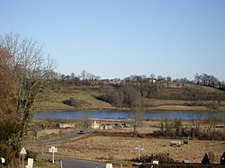
The Gabas (French pronunciation: [ɡabas]; Occitan: Gabàs) is a left tributary of the Adour, in the Landes, in the Southwest of France. It is 116.7 km (72.5 mi) long.[1]

