Garhani
गड़हनी | |
|---|---|
Village | |
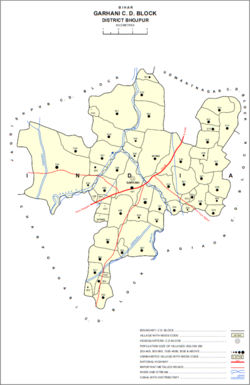
 Map of Garhani block | |
| Coordinates: 25°24′26″N 84°33′19″E / 25.40726°N 84.55539°E[1] | |
| Country | India |
| State | Bihar |
| District | Bhojpur |
| Area | |
• Total | 0.170 km2 (0.066 sq mi) |
| Elevation | 72 m (236 ft) |
| Population (2011) | |
• Total | 5,597[2] |
| Languages | |
| • Official | Bhojpuri, Hindi |
| Time zone | UTC+5:30 (IST) |
| PIN | 802203[2] |
Garhani (Hindi: गड़हनी) is a town and corresponding community development block in Bhojpur district of Bihar, India. As of 2011, its population was 5,597, in 959 households. The total block population was 103,262, in 16,427 households.[2]
- ^ a b "Geonames.org. Garhāni". Retrieved 20 August 2020.
- ^ a b c d "Census of India 2011: Bihar District Census Handbook - Bhojpur, Part A (Village and Town Directory)". Census 2011 India. pp. 27–94, 604–627. Retrieved 20 August 2020.
